
Vietnam, is it an island?
The GEOGRAPHY of Vietnam and Vung Tau.
A simple geography lesson is needed before we jump into something more interesting (history).
People seem confused over whether Vietnam and Vung Tau are islands or not.
One is,
one isn't.
..............
Vung Tau IS an island
and
Vietnam is NOT an island.
People seem confused over whether Vietnam and Vung Tau are islands or not.
One is,
one isn't.
..............
Vung Tau IS an island
and
Vietnam is NOT an island.
Island - definition Island, any area of land smaller than a continent and entirely surrounded by water. Islands may occur in oceans, seas, lakes, or rivers.
https://www.britannica.com/science/island
https://www.britannica.com/science/island
The Geography of VUNG TAU
Vung Tau is a group of islands. There are three main islands in the group; Vung Tau, Long Son and Go Gang.
The following google map, downloaded 24 Feb 2018, clearly shows a handful of other smaller islands too.
https://www.google.com/maps/place/V%C5%A9ng+T%C3%A0u,+Ba+Ria+-+Vung+Tau,+Vietnam/@10.4086215,107.0783462,12.42z/data=!4m5!3m4!1s0x31756fd4554f0cf5:0xb24fd23bf641fa40!8m2!3d10.4115078!4d107.1362686
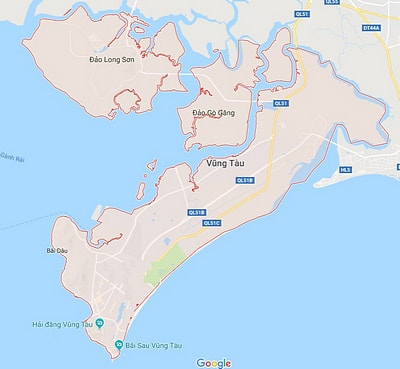
An accurate map of Vung Tau Island.
The largest of the Vung Tau Island group is Vung Tau. It is divided from the mainland by the Co May River.
There are now three bridges accessing Vung Tau Island.
Government tourist brochures are are now referring to Vung Tau as Vung Tau Island.
There are now three bridges accessing Vung Tau Island.
Government tourist brochures are are now referring to Vung Tau as Vung Tau Island.
The following 1906 French map by G. Butteux shows that Vung Tau appeared to be a region within Baria Prefecture(?).
It makes sense that at one time it also included what we call Vung Tau Island today.
The arrival of Europeans changed the name of the island to suit them.
Shortly after the re-unification of Vietnam in '75, it would have been Vietnamized again.
It makes sense that at one time it also included what we call Vung Tau Island today.
The arrival of Europeans changed the name of the island to suit them.
Shortly after the re-unification of Vietnam in '75, it would have been Vietnamized again.
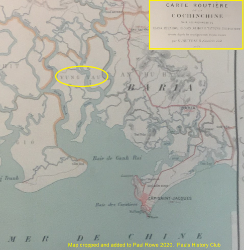
Ye olde Vung Tau region - 1906.
The Geography of Vietnam
Vietnam is not an island (however it does have many islands).
Vietnam is bordered with China to the north and Laos and Cambodia to the west.
https://www.google.com/maps/@16.1389682,104.4454918,6z
Vietnam is bordered with China to the north and Laos and Cambodia to the west.
https://www.google.com/maps/@16.1389682,104.4454918,6z
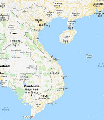
An accurate map of Vietnam.
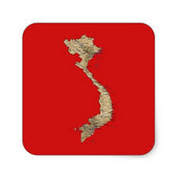
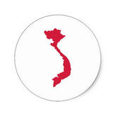
It is easy to see how this confusion can occur. Tee-shirts and bumper stickers clearly show Vietnam as an island.
Add to this that the Vietnamese love the fact that the shape of Vietnam looks like a dragon. So every effort is made to emphasize the lucky shape.
Add to this that the Vietnamese love the fact that the shape of Vietnam looks like a dragon. So every effort is made to emphasize the lucky shape.
Bumper sticker - guilty
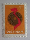
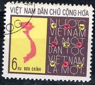
Stamp - guilty
|
Bumper sticker - guilty
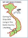
My book cover - guilty
|
Stamp - guilty

My favourite tee-shirt - guilty
|
There we go, another mystery solved.
Vung Tau is an island.
I live on an exotic, tropical island. Love it!
Vung Tau is an island.
I live on an exotic, tropical island. Love it!
VIETNAM HISTORY
AND OTHER GOOD STUFF
Post by Paul Rowe 05/2017, Vung Tau island, Vietnam.
AND OTHER GOOD STUFF
Post by Paul Rowe 05/2017, Vung Tau island, Vietnam.
