A rare, lost, Chinese Map rediscovered!
Part 2:
The Importance of the Selden map:
its importance to present-day Vietnam.
The Importance of the Selden map:
its importance to present-day Vietnam.
Part two moves away from an emphasis on Mekong Island, and now looks at Vietnam and the part it plays on this rare map.
Please note:
For the most part, I will be referring to the long ‘S’ shaped coastline in south east Asia as Vietnam. At the time of this map, this land was NOT Vietnam. It did not become Vietnam until 1802.
I will refer to it as Vietnam simply for convenience, because across time that resource-rich strip of coastline has been claimed by many nations; sometimes at the same time. It can be very confusing.
I also feel comfortable about referring to it as Vietnam, because by the time this map was drawn there were already thousands of Viets living there. In fact, there were so many Viet people living south of Dia Viet, that just four years after this map was drawn, the “king of Cambodia … let the Viet set up two custom-posts” in the region. Vo Hong Lien,The Making of Saigon, 2013.
**
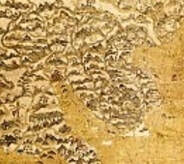
Selden map - 'S' shaped coastline of present day Vietnam.
One: The people.
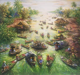
The peasants had migrated from Dia Viet (around Hanoi), to the fertile areas of the Mekong and Saigon deltas. On those deltas it was possible to grow four rice crops per year. The northern rice farmers from Dia Viet on the Red River delta, were lucky to get two crops per year.
The peasants had migrated from Dia Viet (around Hanoi), to the fertile areas of the Mekong and Saigon deltas. On those deltas it was possible to grow four rice crops per year. The northern rice farmers from Dia Viet on the Red River delta, were lucky to get two crops per year.
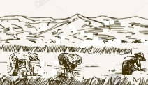
Busy peasant farmers.
But they migrated south by the hundreds. How did they do this?
This mass southerly migration was actually a result of a Chinese retirement plan for their retiring army Generals. To be more specific it was a Mongolian plan – China was dominated my Mongolia for an extended period. It was a pension plan drawn up by Genghis Khan, which fueled the mass migration to the rice fields.
This pension plan was adopted by the Emperor of Dia Viet (Dia Viet was going to be called the northern region of Vietnam one day)
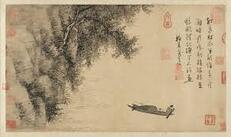
Chinese calligraphy. metmuseum.org
A retiring Viet general was entitled to;
This pension scheme was brilliant. It was a win, win for all.
- keep some of his soldiers,
- keep some weapons,
- free farming implements,
- free rice seed, and
- pay no tax on his farm for the first few years.
This pension scheme was brilliant. It was a win, win for all.
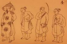
Traditional Viet society. blogs.bl.uk
The Emperor;
- had the lifetime service of a general (the general was being paid by the Emperor),
- when the general retired (and was NOT paid by the Emperor any more), the Emperor ensured the service of the general until his death.
- The greedier the general, the more free land the Emperor accrued.
- was guaranteed high quality farming land for his services, (sure, he was expected to pay rent to the general, but he could grow four crops per year!)
- could rent virgin land from generals,
- could harvest four crops per year (their quality of life would rise quickly).
Of course, the then owners of the region, the Chams, the Khemers, the various mountain tribes, etc., did not benefit from this pension plan.
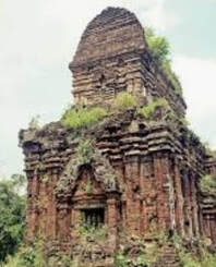
Cham ruins. khiri.com
We have to remember that there were two pension schemes running in the same region at the same time. The Chinese generals were also retiring on the fertile southern deltas. They had probably been retiring there before the Viets.
So, after a while there were 100s of greedy generals, complete with soldiers, grabbing more and more land. It was a mess. Chaotic and deadly. This was frontier land, and very few rules applied. I call this period, right up to 1802, The Warring Warlords period.
The migrating peasant farmers could obtain their super, fertile farms, and riches, but it came at a huge risk.
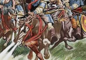
Warring Warlords. History.com
Two: The place.
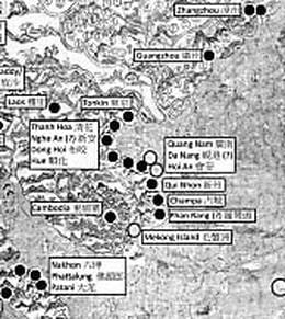
The deltas were not the only resource rich segments of Vietnam. Look at the map. The twelve important trading ports were spread along the coast. The whole place was resource rich. No wonder everyone wanted it.
The deltas were not the only resource rich segments of Vietnam. Look at the map. The twelve important trading ports were spread along the coast. The whole place was resource rich. No wonder everyone wanted it.
Most of the coastline which joined the Dia Viet, in the north, to rich rice deltas in the south, was jungle. These jungles were also resource rich.
Minerals, gem, rare timbers, herbs, sandalwood, ivory, silver, furs, feathers, exotic birds, exotic animals, skilled crafts people, skilled traders, ……
The coastline itself was also resource rich.
Abundant and diverse marine life, fish, mother of pearl, coral, turtle shell, cowrie shells (a widely accepted Asian currency), skilled fishing families, skilled boat builders, fresh water, and 1000s of nautical miles of east, west rivers which connected the coast to the inland wealth.
As a bonus, the whole country was breathtakingly beautiful.
“This region particularly well-suited to maritime exploitation and dependence on marine resources, is also strategically located on the trade routes between southern China and the MalayoSiamese isthmus. Natural elements contribute greatly to this vital crossroads in maritime trade. The trade winds and currents dictate the direction of the voyages and thus the cultural exchanges, while the monsoon regime forced merchants, travelers, soldiers, monks or ambassadors to stop in Vietnam's harbours for several months at a time, where they mingled with local seafarers and inhabitants. The region reaped benefits from this geographical position by selling its own products and by offering in its harbours shipping services, boat repairs, warehousing, accommodation, food, markets, etc., while the rulers could also gain from taxing ships and merchants. This strategic location and the topography …” The Vietnamese Coastline: A Maritime Cultural Landscape, p. 138, Pham, C. M. H., in: Chandra, S. and Ray, H. P. (eds), The sea, identity and history: from the Bay of Bengal to the South China Sea, pp. 137–168. Delhi, Manohar Publishers.
And everybody wanted it, or part of it.
Maritime traders were, by and large, happy to buy what they wanted, and ship it around the world.
One look at the Selden map shows that there were thirteen marine trading ports of interest to foreign traders along the Vietnam coast and river systems. That number of ports confirms there was a lot of international trading taking place at that time.
One look at the Selden map shows that there were thirteen marine trading ports of interest to foreign traders along the Vietnam coast and river systems. That number of ports confirms there was a lot of international trading taking place at that time.
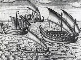
Asian ship[s]. unesco.org
To reiterate, the Selden map drives home the often-overlooked facts that the Viets were;
In my second book about Vietnam, Ancestors and ATMs, I talk about Vietnam having its recent history stolen. Stolen by the colonizers who dominated and disassembled Vietnam prior to 1975.
- skilled traders,
- had the infrastructure in place to ensure international trade,
- where technologically advanced (ship building, repairs and design),
- where socially advanced (had customs officials and military to ensure safe trading for their international guests)
- and much, much more.
In my second book about Vietnam, Ancestors and ATMs, I talk about Vietnam having its recent history stolen. Stolen by the colonizers who dominated and disassembled Vietnam prior to 1975.
In modern times, land-grabbing colonizers follow a few, well-proven colonizing techniques:
These techniques over time, completely erase a nation's greatness, history and identity.
The Viet’s history was also stolen in ancient times.
- Make it sound as if there was nothing important or worthwhile in the colony before the colonization land - grab takes place.
- Constantly refer to the original inhabitants as troublesome savages. This justifies the expenditure needed to erase identity. “Missionaries were needed to convert the local ‘pagans’. Teachers were needed to educate the ‘primitives’. Soldiers were needed to suppress the lawless, restless ‘savages’; lots and lots of soldiers” My Vietnam Stories, 2019, p.99, Rowe, Paul.
- Make it sound as if anything thing good in the new colony was built and supplied by the colonizers.
These techniques over time, completely erase a nation's greatness, history and identity.
The Viet’s history was also stolen in ancient times.
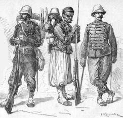
Tonkin expeditionary corps. en.wikipedia.org
The discovery of the Selden map,
returns some of the Viet’s stolen history,
and corrects some of
the intentionally spread lies.
returns some of the Viet’s stolen history,
and corrects some of
the intentionally spread lies.
Following is an example of just one blatant lie used to erase Viet history?
“Vietnamese people were often considered 'poor sailors afraid of the sea'” Chandra, S. and Ray, H. P. (eds), The sea, identity and history: from the Bay of Bengal to the South China Sea, pp. 161-2. Delhi, Manohar Publishers.
'poor sailors afraid of the sea'!
How could this really be?
But history rarely mentions this important, impressive pre- French shipyard, the high quality ships, or the Viet sailors who sailed them.
Erased from history.
And so the lie about Vietnamese being poor sailors afraid of the sea, festered and grew.
- Even the French anthropologists described the Vietnamese as a fishing culture. The Vietnamese did not fish safely off coastal piers with fishing rods and recliner chairs. They did open water netting. A dangerous, but necessary occupation. Of course, they were afraid of the sea. What fishermen aren’t? The sea is full of dangerous spirits and natural phenomena. This is the reason for all the ancient shrines along the coast. In spite of the fear of the sea, generations of quality fishing and sailing happened.
Erased from history. - Before the French arrived and built their Ba Son shipbuilding yard on the banks of the Saigon River, there was already a royal shipbuilding and cannon foundry at that same spot. “The shipyard’s founder was Nguyen Phuc Anh who … established the Chu Su royal naval workshop … to assemble a fleet of modern warships” Tim Doling, Saigoneer. The yard was world class well before the French formally arrived. According to Captain John White an American mariner who visited Gia Dinh in 1819, the royal shipyard was impressive. “Indeed it may vie with many of the naval establishments in Europe … The ship timbers and planks excelled anything I had ever seen … The Annamites are certainly most skillful naval architects, and finish their works with great neatness. Cochin China is perhaps, of all the powers in Asia, the best adapted to maritime adventure … her facilities … the aquatic nature of her population … rivaling the Chinese as sailors” Tim Doling, Saigoneer.
But history rarely mentions this important, impressive pre- French shipyard, the high quality ships, or the Viet sailors who sailed them.
Erased from history.
And so the lie about Vietnamese being poor sailors afraid of the sea, festered and grew.
As I said before,
the discovery of the Selden map,
in a small way, helps return some of
the Viet’s stolen history and corrects intentionally spread lies.
the discovery of the Selden map,
in a small way, helps return some of
the Viet’s stolen history and corrects intentionally spread lies.
NOTE: If you missed the first part of this article about the Selden map, go to the menu on the left and click The Mystery of Mekong Island. Enjoy the read.
In this article I mention some books I have written about Vietnam.
To find out more click below.
To find out more click below.

VIETNAM HISTORY
AND OTHER GOOD STUFF
AND OTHER GOOD STUFF
Please LEAVE a COMMENT. CLICK the ridiculously small blue Comments button below.
Thanks
Paul Rowe
Thanks
Paul Rowe


 RSS Feed
